views
Cyclone ‘Biparjoy’, which is expected to make landfall on the Gujarat coast on Thursday, is set to become the longest-lived cyclonic storm in the Arabian Sea. It formed over the Arabian Sea on June 6 and has been in existence for about eight days, while it will remain in effect for some more days while making landfall, as per the MeT.
According to data from the India Meteorological Department (IMD), ‘Biparjoy’ is also the third cyclone to strike the western state in June after 1965. Before this, only two severe cyclones – first in 1996 and second in 1998 – passed over Gujarat in June. The 1998 cyclone was ‘extremely severe’ and struck the coast of Porbandar with heavy wind speeds of over 160 kmph; it killed 1,176 people and left thousands more injured.
In the category of ‘severe’ cyclone (with wind speeds of 88 kmph to 117 kmph) in June, Gujarat has experienced five cyclones since 1891. ‘Biparjoy’ with a ‘very severe’ cyclonic storm and maximum sustained wind speed of 125 to 135 kmph gusting to 150 kmph is expected to cross Saurashtra, Kutch and nearby Pakistan – between Mandvi in Gujarat and Karachi in Pakistan. It is the first cyclone to hit Gujarat’s coast in June after 25 years.
Taking a look over the Arabian Sea, 13 cyclones developed in June between 1965 and 2023, excluding ‘Biparjoy’. Six of these weakened over the Arabian Sea, two crossed the Gujarat coast, one each in Maharashtra, Pakistan, Oman and Yemen. Among them, 2019’s ‘Kyarr’ was extremely dangerous and had a lifespan of nine days and 15 hours.
According to the World Meteorological Organisation, the term ‘Biparjoy’ was suggested by Bangladesh and means ‘disaster’ or ‘calamity’ in Bangla. “Its damaging potential could be extensive,” said IMD chief Mrutyunjay Mohapatra.
Here is what to expect when the cyclone makes landfall:
- Destruction of thatched houses/extensive damage to kutcha houses
- Some damage to pucca houses
- Potential threat from flying objects
- Bending/uprooting of power and communication poles
- Major damage to kutcha and pucca roads
- Flooding of escape routes. Disruption of railways, overhead power lines and signalling systems
- Widespread damage to standing crops, plantations, orchards, falling of green coconuts and tearing of palm fronds
- Bushy trees like mango to be blown down
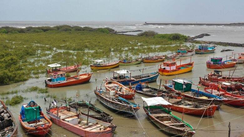
- Small boats and crafts may get detached from moorings
- Visibility severely affected due to salt spray.
Here is a list of dos and don’ts as per National Disaster Management Authority:
Indoors:
- Switch off electrical mains and gas supply
- Keep doors and windows shut
- Remove dead or dying trees/branches close to the house
- Board up glass or put storm shutters in windows and doors
- If the house or shelter is weak, move to a safer place before the cyclone hits
- If the house is securely built, take shelter in the safest part
- Move valuable articles to upper floors
- Keep an emergency kit and first aid box ready
- Store small and loose things that can easily fly away in a safer place.
Outdoors:
- Strictly avoid loose and dangling electrical wires
- Move to nearby shelters
- Follow instructions of the person in charge at shelters
- Remain in the shelter until you are informed to return home
- If you have to drive, do so carefully.
What should you have in an emergency kit?
- Lantern filled with kerosene
- Battery operated torches
- Emergency lights
- Enough dry cells
- Dry non-perishable food
- Drinking water in suitably covered vessels
- Medicines
- Transistor radio
- Extra batteries for transistor
- In all the above situations, the most important is to rely only on official instructions or information and not follow any rumour and fake information. Complain immediately if you receive other kind of information.


Comments
0 comment