views
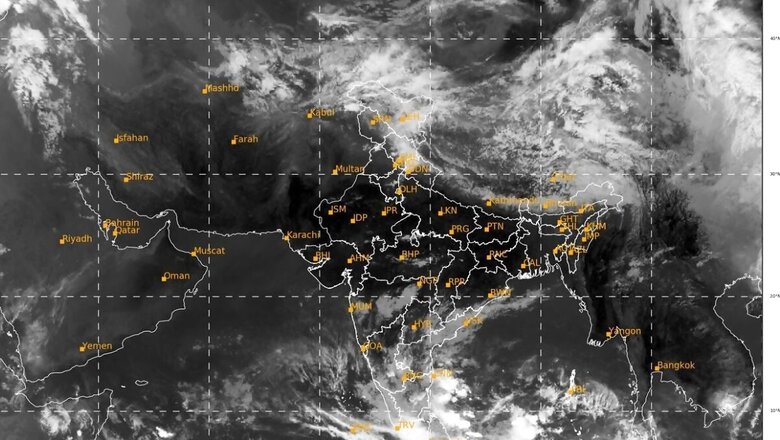
The India Meteorological Department on Sunday said a low pressure area was likely to form over the Bay of Bengal on May 8, which is predicted to further intensify into a depression and a cyclonic storm on May 9.
On Saturday, the MeT signalled a cyclonic circulation formed in the southeast Bay of Bengal, seen as the first step of the development of a possible severe cyclonic storm in the region next week. “Yesterday’s cyclonic circulation over southeast BoB lay over southeast BoB & adjn South Andaman Sea at 0830 IST of 7th May. LPA is likely to form over the same region on 8th May. To intensify into a depression over SE BoB around 9th May. To intensify into a cyclonic storm,” the IMD said.
Yesterday’s cyclonic circulation over southeast BoB lay over southeast BoB & adjn South Andaman Sea at 0830 IST of 7th May. LPA is likely to form over the same region on 8th May. To intensify into a depression over SE BoB around 9th May. To intensify into a cyclonic storm pic.twitter.com/ewICcr7kpC— India Meteorological Department (@Indiametdept) May 7, 2023
The weather office earlier said the cyclone will be named Mocha (Mokha), a name suggested by Yemen after the Red Sea port city known to have introduced coffee to the world over 500 years ago, reported news agency PTI.
“A cyclonic circulation lies over southeast Bay of Bengal and its neighbourhood in lower and middle tropospheric levels. Under its influence, a low pressure area is likely to form over the same region by May 8,” said Mrutyunjay Mohapatra, director general, India Meteorological Department (IMD).
Mohapatra said the details about the cyclone’s path and intensification will be provided after the formation of a low-pressure area (LPA). According to him, the weather system is likely to concentrate into a depression over southeast Bay of Bengal around May 9 and intensify into a cyclonic storm and move nearly northward towards central Bay of Bengal.
Rainfall in Andaman, Andhra Pradesh, Odisha
The IMD predicted “heavy to very heavy rainfall and squally winds” over Andaman and Nicobar Islands from May 8 to 12. It also issued a ‘rain watch’ alert for districts in Andhra Pradesh and Odisha between May 7 and 9. The weather office forecast moderate to severe rain in isolated pockets of the eastern coast.
“Thunderstorms accompanied by lightning expected at isolated places over North Coastal Andhra Pradesh, Yanam, and South Coastal Andhra Pradesh and thunderstorms coupled with lightning and gusty winds with 30-40 kmph speed expected at isolated places over Rayalaseema,” the IMD said in its weather bulletin.
Districts like Srikakulam, Vizianagaram, Parvathipuram, ASR, Anakapalli, Eluru, Ubhaya Godavari, NTR, Guntur, Krishna, Palnadu, Prakasam, Nellore, Tirupati, Nandyala, Chittoor, and parts of Kadapa and Annamayya are likely to receive rain.
The IMD issued a cyclonic storm warning for 18 districts in Odisha – including Balasore, Bhadrak, Jajpur, Kendrapada, Cuttack, and Puri – with yellow notice for nine.
Fishermen on alert for five days
The IMD warned fishermen of squally weather for the next five days, in southeast Bay of Bengal with wind speed reaching 40 to 50 kmph from Sunday.
pic.twitter.com/R2evBu4VSa— India Meteorological Department (@Indiametdept) May 6, 2023
“Those who are over southeast Bay of Bengal are advised to return to safer places before May 7 and those over central Bay of Bengal are advised to return before May 9,” the IMD said in its warning issued till May 10.
It has also suggested that tourism and offshore activities as well as shipping near Andaman and Nicobar Islands are regulated between May 8 and 12.
(With PTI inputs)
Read all the Latest India News and Karnataka Elections 2023 updates here


Comments
0 comment