
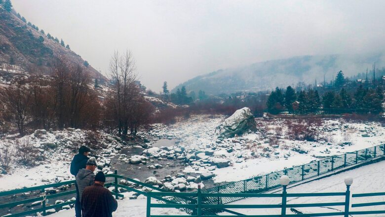
North India is all set to witness this winter’s first intense spell of snowfall and rain with three back-to-back western disturbances impacting the region this week. According to the India Meteorological Department (IMD), the systems will bring widespread heavy snowfall over Jammu and Kashmir, and Himachal Pradesh till January 4 – and scattered rains in the plains.
The rains which commenced over Jammu and Kashmir on Monday come as a piece of good news for the Western Himalayan region which has remained largely deprived of any snow this winter. There was a glaring lack of western disturbances this winter which is also an El-Nino year. Normally, 5-7 western disturbances impact the region from December-January. However, this time they were just 1-2 and very feeble at that. Most of the hill stations remained dry all through December and January raising concerns over the water shortage.
However, the ensuing spell is expected to reduce the deficit to some extent. Apart from the higher reaches, the plains of Northwest India – Punjab, Haryana as well as parts of Delhi – are also expected to witness scattered rains over the coming week.
“We are expecting a good amount of rainfall from January 29 to around February 4. It is likely to gain intensity over the next few days,” said senior IMD scientist AK Singh. The IMD has also issued an orange alert for heavy snowfall/rain over Jammu and Kashmir for January 31.
END TO LONGEST FOG SPELLS
The rains will also reduce the intensity of dense fog that enveloped the region for most part of January – in one of its longest spells. The dense fog conditions persisted over the plains of Northwest India since December 25. It was maximum in intensity and duration on January 14 when visibility dropped to zero over entire north Indian plains from Amritsar to Dibrugarh across Haryana, Delhi, UP and Bihar.
According to the IMD, fog conditions are likely to prevail in Delhi, some parts of Uttar Pradesh and Bihar, Rajasthan, Punjab for another two days, and decrease thereafter.
People are also expected to get some relief from the intense cold conditions, as no cold wave is expected this week. However, ‘cold days’ are likely to continue in parts of Uttar Pradesh and Bihar. A cold wave is declared when the minimum temperature drops at least 4.5 to 6.5 ℃ below normal, and can take a toll on the health if it continues for a prolonged period in the plains.
MINIMUM TEMPERATURES TO RISE BY 2-4℃, NO COLD WAVE THIS WEEK
The minimum temperatures have continued to hover between 7℃ to 10℃ over the Northwest plains over the last few days, while maximum temperatures remained around 11-13℃. According to IMD, the night temperatures are now likely to rise by 2-4°C over many parts of Northwest and Central India during the next four days.
The national capital which has also remained largely dry this winter in the absence of any rain could also experience scattered showers or drizzle around January 31, and February 3-4 with cloudy skies, and surface winds gathering speed. According to meteorologists, this is likely to bring some respite from the intense, dry cold weather conditions that have gripped the region over the last one week, with dense fog making the visibility worse.
The day temperature was recorded at around 18℃ on Sunday in Delhi’s Palam and Safdarjung observatories, while the night time temperatures plummeted to 6℃, both were around 2-3℃ below normal.


Comments
0 comment