
views
X
Research source
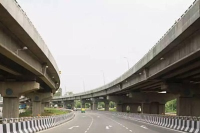
I-190 (both the Niagara Thruway and Niagara Expressway) will take you from where you are to where you need to be. This article describes this route.
Travel in Erie County.
In Erie County, not only will you start your route, but you'll also travel through some of the larger cities of Buffalo and Tonawanda. It starts out going almost full west, then dips a little, curves, and heads into downtown Buffalo, curving north and running along the edge of the Niagara River until it comes out just north of Riverside Park where it curves to the east and travels out of Tonawanda onto Grand Island. It's Niagara Amusement Park and Splash World and heads curvy north until it passes the other side of the Niagara River at the northwest corner of Grand Island and into the next county. This route is tolled at a total Tolls By Mail price of $1.24 or as E-ZPass rates of $0.95 (started within New York) or $1.09 (started outside New York). This portion of the route is called the Niagara Thruway and is maintained by the New York State Thruway Authority. This portion of the route is nearly 21.12 miles (33.99 km) long, so most of the route happens here. Begin your route. The route begins in Cheektowaga at exit 53 on I-90 (New York Thruway). This exit is just north of the West Seneca town and east of the Buffalo city lines. In Buffalo, expect exits for South Ogden St (1), NY-354 to NY-62 (2), NY-16/Seneca St (3), Smith St/Fillmore Ave (4), Hamburg St/Louisiana St (5, depending on your direction of travel), Elm St (6), NY-5/LECT W or Church St (7), NY-266/Niagara St (8), LECT/Porter Ave/Niagara St (9), NY-198/Scajaquada Expressway (11), Amherst St (12), Austin St (13), and Ontario St/Vulcan St (14). At first, the interstate passes the former City Line toll barrier before it reaches its exit 1. After exit 3, you'll pass between the KeyBank Center and Sahlen Field (near NY-5, exit 7) with some connection to Lake Erie nearby. It then follows the Niagara River, as it makes its way to the north. In Tonawanda, expect exits for NY-324/Sheridan Dr/Kenmore Ave (15), I-290 to I-90 (16), NY-266/River Rd (17) and the Tonawanda Toll Gantry. The highway follows the Black Rock Channel in this stretch and passes the former Black Rock Toll Barrier, before re-hooking up with the Niagara River. Cross the South Grand Island Bridge. The South Grand Island Bridge crosses the Niagara River for the first time as a dual pair of truss arch bridges. Tolls start at $1.24 (Tolls by Mail) $0.95 (E-ZPass NY-started), $1.09 (E-ZPass non-NY-started) but rise with additional axles or features. On Grand Island, expect exits for NY-324 W/Grand Island Blvd (18A), Beaver Island State Park (18B), Whitehaven Rd (19), NY-324 E/Grand Island Blvd (20B), West River Rd (20A), and the Niagara Falls Toll Gantry. The highway parallels NY-324 across Grand Island but passes Niagara Amusement Park &Splash World from opposite sides of the central portion of the island. Cross the North Grand Island Bridge. The North Grand Island Bridge crosses the Niagara River for the second time as a dual 2-lane pair of truss arch bridges, and where it exits Erie County. Tolls start at $1.24 (Tolls by Mail) $0.95 (E-ZPass NY-started), and $1.09 (E-ZPass non-NY-started) but rise with additional axles or features.
Travel in Niagara County.
In Niagara County, you'll continue traveling mostly north but curve east near the Fashion Outlets of Niagara Falls USA area and curve west as you enter Lewiston until it crosses into the next area. You'll cross through Niagara Falls, NY, Niagara, and Lewiston. This portion of the highway is officially called the Niagara Expressway and isn't tolled, but is maintained by the New York State Department of Transportation. This portion of the route is by far the shortest portion of the route - only lasting 7.22 miles (11.62 km). In Niagara Falls, expect exits for NY-384/Buffalo Ave/Niagara Scenic Parkway (21), LaSalle Expressway (21A), and US-62/Niagara Falls Blvd to Niagara Falls International Airport (22). Exit 21 is a complex exit, due to that exit being the last exit where NY-324 terminates and two other parkways/expressways forming most of the exit's needs. In Niagara, expect exits for NY-182/Packard Rd/Porter Rd (23) and NY-31/Witmer Rd (24). Exit 24 is the access route to the Robert Moses Niagara Power Plant reservoir, however, the highway crosses a canal on a dam used by the NY-265 state route. In the Town of Lewiston, expect exits for NY-265 (25A) and NY-104/Niagara Scenic Parkway (25B). Cross the Lewiston-Queenston Bridge. This bridge crosses into Ontario, Canada as an arch bridge above the Niagara River containing five lanes of reversible traffic. It is currently tolled at $5.00 (USD) or $6.50 (CAD) with customs at the end of the bridge plaza. Continue into Canada. In Canada, it crosses into Niagara-on-the-Lake, ON, and becomes Canada Highway 405 W towards Catharines/Hamilton and Toronto. This is the only auxiliary interstate that links the United States directly to Canada.








Comments
0 comment