
- On mobile, input a destination in the Google Maps app. Enter a starting point address, and then tap the person icon to view walking distance.
- On desktop, input a destination in Google Maps. Enter a starting point address, and then click the person icon.
- If you want turn-by-turn directions on your mobile device, tap "Start" to begin your route.
Using Mobile
Open the Google Maps app. You can use the mobile web version, but it's recommended to use the app. Google Maps is available for iOS in the App Store and for Android in the Google Play Store.
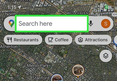
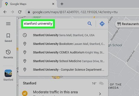
Enter a destination address. Use the search field at the top to input an address, or adjust the map to tap a location.

Tap Directions. This is the blue button with a right-facing arrow inside.

Input a starting point address. Use the first field to enter a starting location. As you type an address, Google will offer suggestions. Tap an address to input it. If you have Location Services turned on, the starting point address may already be your current location. Otherwise, you can tap Your location and allow Google to find you on the map.

Tap the person icon. This will be below the destination address. You'll be able to see other travel methods, such as Driving, Transit, Cycling, and Flight. The person icon represents Walking.
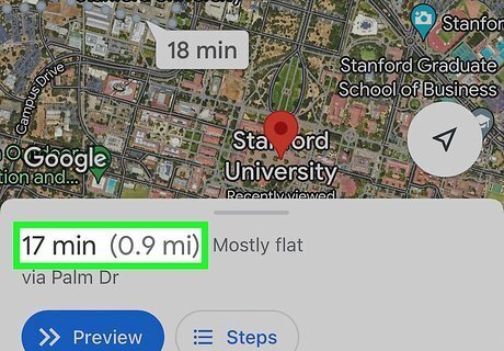
View the walking distance. Once you select Walking as your travel method, you'll find the total walking distance and duration of the route at the bottom of the screen. If you want get turn-by-turn directions as you walk, tap Start to begin your route.
Using Desktop

Go to https://maps.google.com/ in a web browser. You can use Google Chrome, Safari, Microsoft Edge, or another browser.
Enter a destination address. Use the search field at the top to input an address, or adjust the map to select a location.

Click Directions. This is the blue button with a right-facing arrow inside.

Input a starting point address. Use the first field to enter a starting location. As you type an address, Google will offer suggestions. Click an address to input it.

Click the person icon. This will be above the starting point address. You'll be able to see other travel methods, such as Driving, Transit, Cycling, and Flight. The person icon represents Walking.

Select a route. If there are multiple routes to your destination, select the one you want. If there's only one route, skip this step.

View the walking distance. Once you select Walking as your travel method, you'll find the total walking distance and duration of the route at the top of the screen, underneath the addresses.


Comments
0 comment